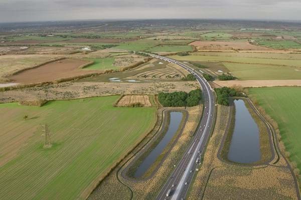
National Highways has released a 'fly-through' video of the Lower Thames Crossing (LTC) under the new design that the government's planning authority will examine.
Plans for the 14.5-mile scheme would see a new tunnel under the Thames from east of Gravesend in north Kent to Tilbury in Thurrock.
The video was released to coincide with the Planning Inspectorate opening registration for members of the public, stakeholders and landowners to take part in the next stage of the planning process.
The new fly-through gives a bird's eye view of the proposed LTC scheme, using a 3D computer model of the new road blended with real video footage.
It shows 'how the route has been designed to sit sensitively in the landscape with 80% of the road below ground level through the use of cuttings, embankments and the tunnel'.
The video shows the route 15 years after the road opens, showing the scale of proposed planting and public open space, including two new public parks, seven green bridges and over one million extra trees.
Changes made to the design in Thurrock and presented in the project's last consultation are also included in the fly-through, such as changes on the north bank of the Thames to make space for the Thames Freeport, and changes to the connection between the Orsett Cock roundabout to the A1089 to reduce traffic impacts on some local roads.
However, Thurrock Council is still opposed to the scheme. It has urged residents to register to comment on the LTC, which it warns could be more expensive per mile than HS2, as part of an examination by planning inspectors this year.
Thurrock said the scheme could cost £10bn but will make only a small and temporary impact on traffic congestion on the Dartford Crossing and would create years of disruption during construction and impose substantial harm on local communities.
It also highlighted concerns that the scheme ‘flies in the face of the UK's carbon reduction targets by creating a legacy of greater car use at a time when less travel is needed'.
National Highways withdrew its original planning application in November 2020 and only resubmitted it late last year. The council pointed out that the Planning Inspectorate website will allow any affected person who wants to comment on the plans to register from Monday (9 January).
Dr Colin Black, the council's assistant director of regeneration and place delivery, said: ‘This plan does not deliver the benefits intended. This scheme, as designed, will cause serious traffic problems on Thurrock's local road network and beyond, as well as creating an outer M25 by stealth between Essex and Kent.
'It would have significant repercussions for future generations in terms of carbon emissions, air quality and children's health. Local residents and businesses would see little benefit and all of the disruption. This is a very expensive road scheme, the case for which relies on its ability to stimulate very significant increases in vehicle use at a time when government is committed to doing the opposite.
'This scheme exacerbates social deprivation in a community identified as a priority for levelling up.'