National Highways is to spend £15.4m on a new network of weather stations and supporting infrastructure that will provide real-time data on road conditions.
The government-owned company said that with its partner Vaisala, it will upgrade 125 weather stations by 2025, replacing existing stations that are up to 25 years old, with plans for around 100 more between 2025 and 2030.
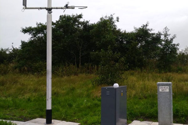
The first weather station was introduced on the A56 near Accrington on Tuesday (24 October).
The new weather stations, also known as Environmental Sensor Stations (ESS), are moving from domain-based data that read weather conditions in the surrounding area, to route-based data that reads weather conditions on a particular road.
Katy Little, project lead for the ESS major replacement programme, said: ‘The weather stations underpin our entire decision making and treatment regime so are pivotal to us ensuring the network is safe and secure.’
The weather monitor itself has a backup battery in the event of power loss, a full suite of sensors and twin cameras facing up and down the road to see the condition of the road. The set-up includes:
- Road surface sensors - embedded within the road surface, installed flush with the surface, the sensors take a variety of measurements and observations of the road surface: used in a road weather station to provide accurate and reliable information on the surface state (wet, dry, icy, frost, snow, chemical/salt presence) and surface temperature.
- Atmospheric sensors (air temperature, relative humidity, precipitation, wind speed, wind direction, visibility) provide information that can be critical to the overall traveling environment.
The information is relayed to National Highways’ Severe Weather Information Service which in turn informs its control rooms across the country.
National Highways said that where its existing weather stations run on landline or modem lines, the new weather stations will run on NRTS (National Roadside Telecommunications Service).